As global urban centers evolve into interconnected smart cities, modern infrastructure operators face an unprecedented challenge. Telecom networks, electrical grids, water mains, and natural gas pipelines must co-exist within increasingly dense urban corridors. Historically, these core domains operated within isolated operational silos—relying on legacy mapping tools, disconnected field dispatching, and fragmented asset databases.
A Unified Utility Management System shifts the operational paradigm from reactive maintenance to proactive, geospatial-driven intelligence. By unifying multi-utility assets within a single, high-precision Enterprise GIS framework, operators eliminate cross-domain risks, streamline workforce execution, and protect critical infrastructure investments.
The Costs of Siloed Infrastructure Operations
Operating utilities independently creates severe operational friction across municipal and enterprise landscapes:
- Excavation & Trenching Risks: Uncoordinated civil engineering projects often lead to accidental fiber cuts, water main ruptures, or power outages due to lack of cross-utility visibility.
- Redundant Field Asset Surveys: Multiple utility teams conducting separate spatial audits along identical geographic corridors inflates Operational Expenditure (OpEx).
- Data Inconsistencies: Legacy Physical Network Inventory (PNI) systems foster discrepancies between field conditions and centralized office databases.
- Slower Incident Response: Isolated monitoring platforms delay root-cause analysis during major outages or environmental emergencies.

Core Pillars of SIT Digital’s GeoFM™ Unified Ecosystem
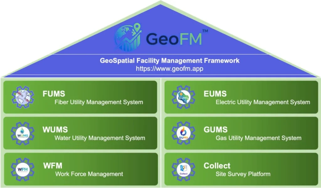
SIT Digital’s flagship GeoFM™ (Geospatial Facility Management) framework serves as the enterprise architectural foundation for unified utility operations. By integrating domain-specific modules over an Esri-powered GIS backbone, GeoFM™ bridges physical network infrastructure with real-time digital intelligence.
1. FUMS™ (Fiber Utility Management System)
Manages the complete lifecycle of Outside Plant (OSP) and Inside Plant (ISP) fiber networks. FUMS™ delivers high-precision route planning, Low-Level Design (LLD), splicing diagrams, and automated cable capacity tracking.

2. EUMS™ (Electric Utility Management System)
Provides spatial mapping for electrical generation, transmission, and distribution assets—including high-voltage substations, transformers, feeder lines, and smart meter nodes.

3. WUMS™ (Water Utility Management System)
Digitizes water distribution lifecycles from reservoirs and pumping stations to primary distribution mains and consumer meters (District Metered Areas). Features leak detection spatial analysis and pressure node mapping.

4. GUMS™ (Gas Utility Management System)
Delivers real-time geospatial visualization of underground gas pipelines, pressure-regulating stations, and consumer valves, complete with pressure-flow analytics and hazard prevention mapping.

5. Seamless Field Integration via Collect-App™ & WFM
Eliminates paper-based field audits. Field engineers use Collect-App™ to capture geo-tagged surveys, asset photos, and position coordinates offline or online, synchronizing directly with the central GeoFM™ repository.

Technical Integration: Connecting Office GIS with Field Execution
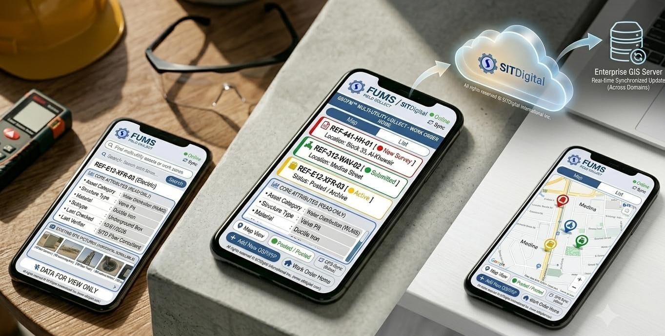
The core strength of the GeoFM™ platform lies in its ability to bridge high-precision spatial planning with real-time field operations. Leveraging the Collect App™, field engineers can conduct physical audits, capture high-accuracy spatial coordinates, and update asset statuses directly from the field.
Through automated synchronization protocols, modifications made on mobile field devices instantly reflect within the enterprise GIS database. This ensures that office teams operating the FUMS Editor App maintain complete, up-to-date visibility into network topologies, active work orders, and potential utility strike risks—eliminating human error and reducing project turnaround times.
Strategic Benefits for Smart Infrastructure Development
Adopting a unified, geospatial approach to multi-utility management delivers measurable operational value across the asset lifecycle:
Utility Strike Prevention: Real-time overlay of fiber, gas, water, and electrical lines prevents catastrophic damage during third-party excavation projects.
Capital Efficiency: Combined field surveys and unified data acquisition reduce redundant field dispatches and overall OpEx.
Regulatory Compliance: Centralized, auditable spatial records ensure seamless alignment with national infrastructure standards and smart city mandates.
Accelerated Time-to-Market: Automated work order dispatch and digital asset inventories streamline network expansions and subscriber rollouts.
Future-Proofing Urban Utilities
As cities become denser and infrastructure dependencies grow more complex, managing utilities in isolated systems is no longer sustainable. The GeoFM™ ecosystem empowers utility providers, municipal authorities, and telecom operators with the digital architecture required to build, manage, and scale resilient smart infrastructure. By unifying spatial data, field workflows, and multi-domain network models into a single operational interface, GeoFM™ sets the benchmark for modern utility management.