National Fiber Governance Platform for Open Access & Multi-Operator Coordination in Saudi Arabia
As KSA’s fiber networks scale under Vision 2030, GeoFM delivers the ultimate digital twin layer. We empower Saudi operators and regulators with unified fiber intelligence to govern, optimize, and streamline shared infrastructure seamlessly.
Core Infrastructure Services for the Saudi Fiber Ecosystem
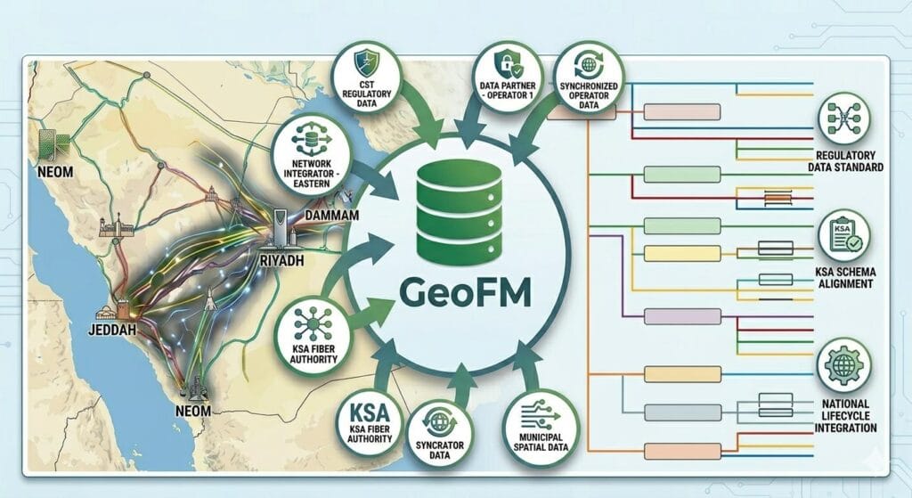
National PNI Data Modeling
Standardizing multi-operator fiber asset data (ducts, cables, splices, and FDTs) directly into a unified schema that aligns perfectly with KSA's regulatory frameworks.
Open Access Compliance Automation
Enabling seamless cross-operator service provisioning and real-time SLA tracking across shared infrastructure networks in Saudi Arabia.

Geospatial Network Engineering & Planning
Advanced OSP design, utility mapping, and duplicate network avoidance to optimize high-capital telecom rollouts across key Saudi economic hubs.

GeoFM Platform Deployment
Integrating our telecom-native governance engine into existing operator systems to provide an end-to-end digital twin of physical infrastructure.
Empowering Saudi Arabia’s Infrastructure with Digital Precision
- Vision 2030 Alignment: We support the Kingdom’s goals by building sustainable and smart digital infrastructure.
- Expert Global Delivery: Leverage our global expertise through a seamless remote model that ensures speed and quality.
- Local Regulatory Compliance: Our designs strictly follow Saudi engineering standards and mapping protocols.
“We empower Saudi enterprises to optimize their infrastructure through precision engineering and geospatial innovation.”
— SIT Digital Team

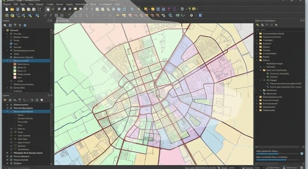
Advanced GeoFM Capabilities for KSA’s Smart Cities
- Real-time Asset Tracking: Monitor underground utility networks with GPS precision.
- Predictive Maintenance: Identify potential faults before they occur using AI-driven geospatial data.
- Unified Utility View: Integration of Water, Gas, and Fiber networks into one single dashboard.
Partner with the experts in Saudi Arabia’s Geospatial revolution. Let’s build the future of Vision 2030 together.
FAQ
Frequently Asked Questions
GeoFM acts as an automated regulatory enforcement engine. It continuously cross-references physical network asset deployments and resource-sharing workflows against the latest CST guidelines to ensure zero duplicate trenching and absolute compliance across shared infrastructure.
Yes, entirely. GeoFM is built on a secure, multi-tenant architecture. While it standardizes data into a unified spatial system, strict cryptographic isolation ensures that every operator’s sensitive infrastructure data remains completely confidential and invisible to competitors
Absolutely. GeoFM features robust, telecom-native API frameworks. It seamlessly syncs with your current operational support systems and municipal planning tools to provide a real-time digital twin without disrupting existing setups
The platform integrates advanced Outside Plant (OSP) design automation with highly accurate utility mapping. By providing a centralized spatial interface, GeoFM allows engineering teams to visualize existing fiber assets across regions, execute predictive modeling, and significantly reduce high-capital network rollout costs.
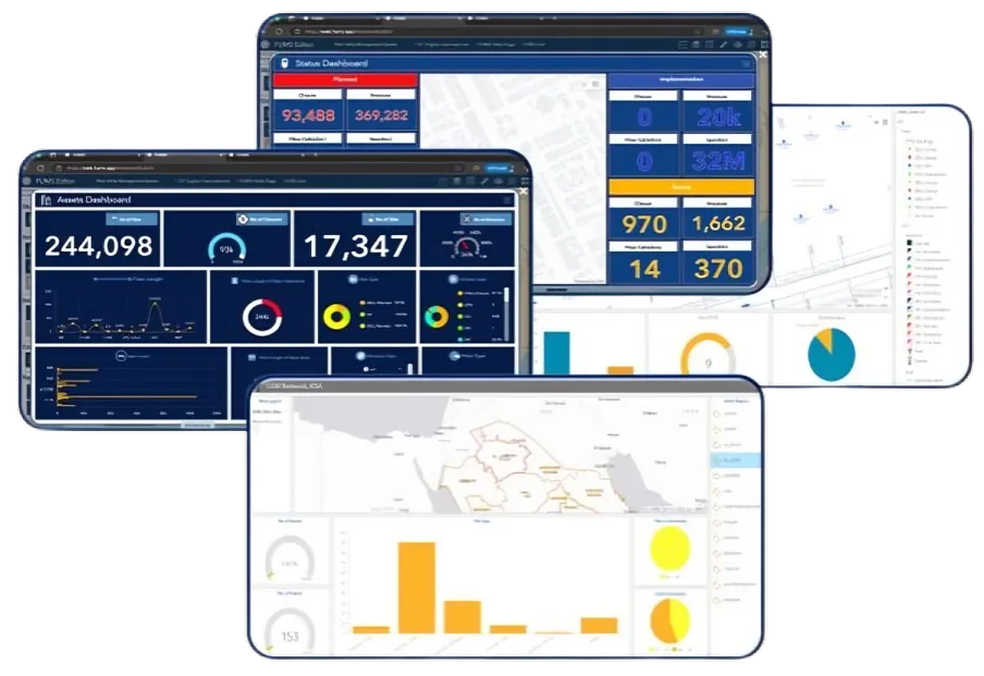
GeoFM operates as a comprehensive parent platform that unifies multiple specialized asset tracking and management frameworks. This includes modular systems engineered for fiber utility mapping, workload allocation, and multi-tenant asset sharing, ensuring an end-to-end operational workflow on a single dashboard
GeoFM accelerates the standardization of the Kingdom’s digital twin infrastructure. By bridging the gap between municipal planning authorities and commercial telecom operators, it provides the transparent, scalable, and automated network data alignment necessary to sustain rapid smart city expansions.