Enterprise-Grade Offline Raster Maps & Datasets
Acquire high-resolution, ready-to-use offline geospatial data layers, vector maps, and satellite imagery tailored for field operations and GIS environments without internet dependency.
Why Organizations Need Offline Map Data?
Field teams often operate in remote areas where internet connectivity is unreliable. Acquiring ready-to-use offline geospatial datasets ensures uninterrupted access to critical map layers for seamless enterprise planning, maintenance, and utility operations.
Zero-Connectivity Reliance
Eliminate dependence on cellular networks. Provide field crews with pre-loaded, high-resolution maps that function perfectly in dead zones and remote terrains.
Mission-Critical Speed
Offline raster datasets load instantly on field devices without buffering, enabling rapid decision-making during utility audits and emergency responses.
Data Security & Privacy
Keep sensitive infrastructure assets and proprietary GIS mapping layers securely stored locally on corporate hardware without cloud exposure.
Cost-Effective Field Operations
Reduce heavy data roaming charges and cloud bandwidth costs by deploying ready-made, multi-layer map packages directly to your field enterprise teams.
Enterprise-Grade Offline Map Dataset Features
High-Resolution Raster Data
Crystal-clear satellite map layers and raster tiles configured explicitly for offline corporate GIS platforms.
Pre-Rendered Vector Packages
Ready-to-load vector datasets containing comprehensive geographical and regional boundaries.
Multi-Format Compatibility
Datasets available in industry-standard formats including ArcGIS, GeoJSON, Shapefiles, and Geodatabases.
Ready-to-Use Basemaps
Complete baseline maps ready for direct deployment into field hardware, tracking systems, and local servers.
Multi-Layer Customization
Extracted map data packed with individual, togglable layers for roads, land parcels, topography, and assets.
Scalable Dataset Sizes
Geodata optimized and compressed efficiently to fit diverse hardware storage capacities without quality loss.
Pre-Indexed Attributes
Maps embedded with offline-ready metadata, asset attributes, and coordinates for instant offline queries.
Offline Point-of-Interest (POI) Data
Comprehensive offline database files containing critical landmarks, roads, and specific coordinates.
SIT Digital’s Ready Map Data Inventory
SIT Digital offers premium, pre-compiled geospatial datasets available for immediate enterprise licensing. Our off-the-shelf data products include high-resolution offline satellite imagery, comprehensive parcel maps, and fully indexed road networks designed to support utility and telecom operations globally.
2.25+ Million Sq Km
Ready-to-License Satellite Coverage
6.5+ Million
Pre-Indexed Land Parcels
2+ Million
GIS-Ready Road Features
Industry Applications

Telecom Operations
Ready offline maps for planning fiber layouts in remote areas.

Utility Companies
Pre-loaded base maps for gas, water, and power asset tracking.

Field Surveys
High-accuracy offline basemaps for surveyors working with zero connectivity.

Emergency Response
Pre-downloaded critical terrain maps for disaster management teams.
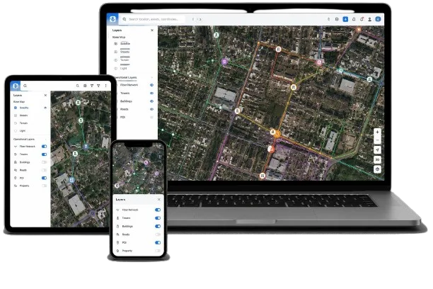
Offline Maps Integrated with GeoFM
Integrate ready-to-use offline map datasets directly into GeoFM to power asset visualization, remote tracking, and critical utility logistics without internet dependency
Network Asset Tracking
Utility Infrastructure Visualization
GIS-Ready Datasets
Logistics Geodata
Analytical Map Layers

How It Works
Select Your Region & Layers
Choose the specific geographic area and map types (Raster, Vector, or Satellite) required for your project.
Format Customization
Define the data formats compatible with your hardware or existing GIS software.
Secure Data Delivery
Download the complete offline map package via secure high-speed servers or encrypted drives.
Direct Offline Deployment
Load the datasets directly onto your field devices or internal enterprise systems
Why Choose SIT Digital
Trusted Geospatial Partner Since 2010
- Global GIS Expertise
- ESRI Technology Partner
- Telecom & Utility Domain Specialists
- Enterprise-Grade Datasets
- Multi-Region Data Coverage
- Custom Offline Map Packages
Frequently Asked Questions
Yes. Organizations can license and download pre-compiled map data packages to access high-resolution satellite and vector layers completely offline on any GIS platform
We provide periodic updates for our datasets. Depending on your licensing agreement, you can receive refreshed raster updates and newly indexed asset layers.
Yes. We supply ready-made offline geospatial data specifically for telecom infrastructure, including fiber route vectors and tower location assets
Our offline datasets are heavily utilized by telecom operators, utility companies (water, gas, electricity), field survey teams, and emergency response organizations.
Yes. We deliver compressed, high-resolution raster satellite imagery optimized for quick loading and offline storage on enterprise devices.
Ready to Acquire Enterprise Offline Map Datasets?
Secure your high-performance raster layers, vector maps, and satellite data packages tailored for offline enterprise GIS infrastructure.